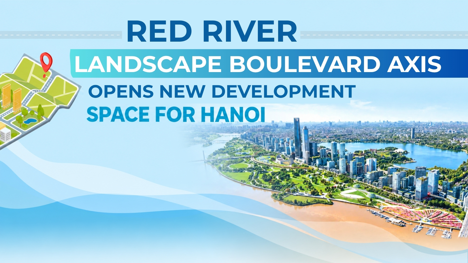
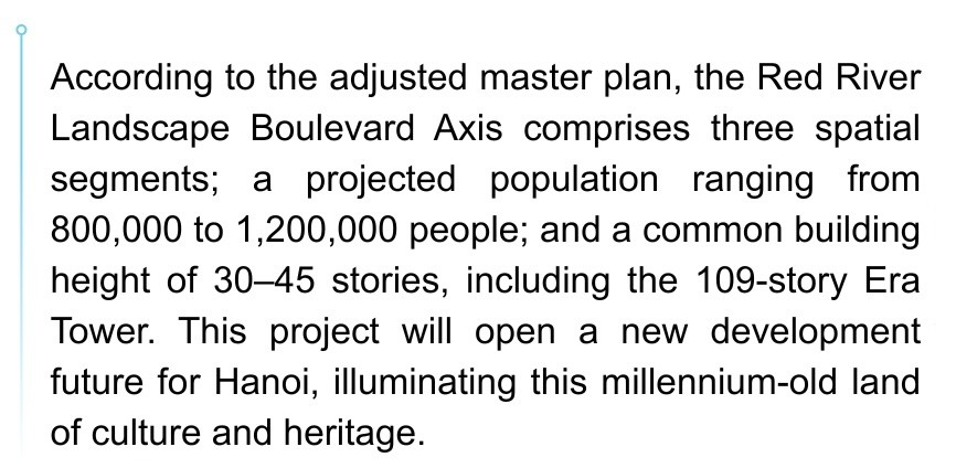

According to the Master Plan, the Red River Landscape Boulevard Axis is identified as one of the nine driving forces for the development of Hanoi Capital. It is also a strategic axis, a central green space axis, as well as an economic, commercial, service, and urban axis associated with creative culture and science-technology along both sides of the river.
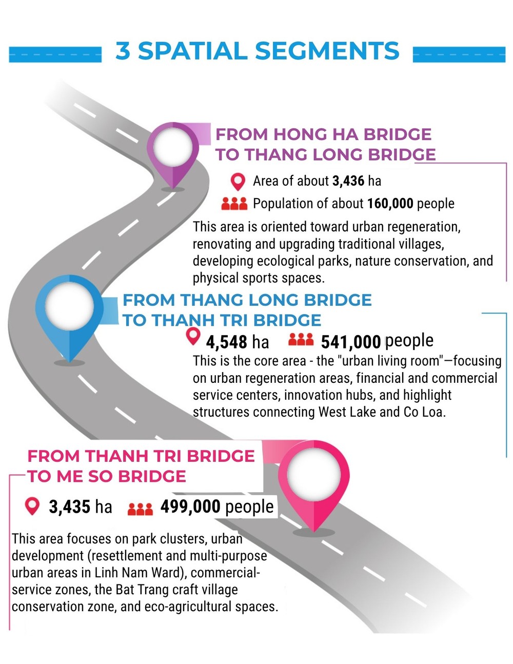
The project’s research scope spans approximately 40 km, extending from Hong Ha Bridge to Me So Bridge, covering 16 communes and wards of Hanoi. The total study area is about 11,418 hectares, with a current population of nearly 280,000 people. The planned area holds immense historical and cultural value, featuring 123 historical site structures, including 1 special national site, 26 national sites, 35 city-level sites, and 61 unranked sites. Additionally, there are 14 commemorative places associated with revolutionary and resistance events.
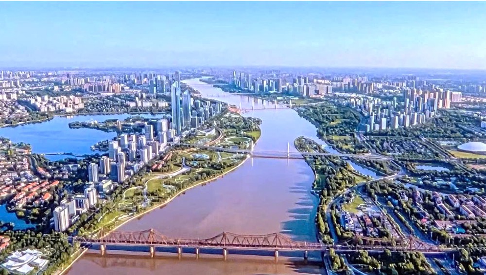
The Red River Landscape Boulevard Axis is oriented to become a strategic space for the capital’s landscape, transportation, and urban development, featuring a new spatial organization mindset that shifts from "turning its back on the river" to "facing the river." Through this, it effectively leverages the landscape, cultural, and historical values of the Red River, creating a modern and civilized urban appearance.
One of the core principles of the plan is "flood adaptation," placing the safety of the dike system and the flood discharge capacity of the Red River above all else. "The core principle is not to narrow the flood passage and not to propose solutions for constructing new dikes within the old dike system," stated the Hanoi Municipal Report.
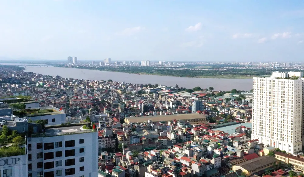

In terms of spatial organization, three orientations—"Safety – Ecology – Transportation"—are prioritized. Flood discharge areas are integrated with adaptation solutions for climate change and natural disasters, ensuring natural drainage and compatibility with the riverbank landscape.
With the boulevard axis, Hanoi will transform the Red River from a space fragmented by the dike system, lacking synchronized infrastructure, and having limited accessibility into a better-connected urban axis with more green and public spaces, while creating further conditions for cultural, tourism, commercial, service, and community activities.
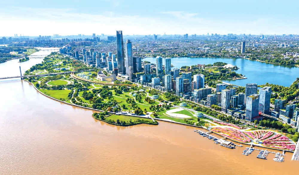
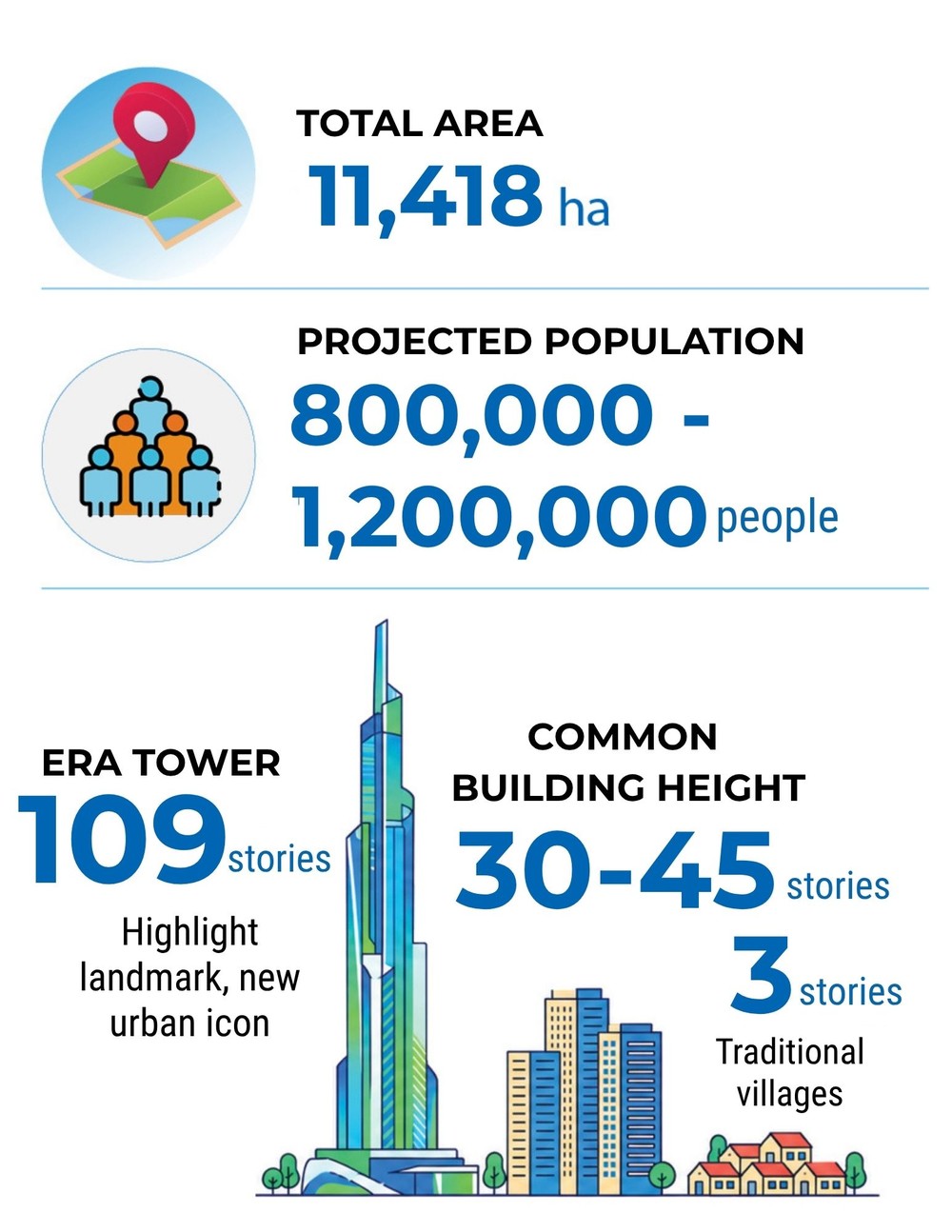
Regarding housing construction planning, the total study area covers about 11,418 hectares, with a projected population of 800,000 to 1.2 million people. The land-use norm for civil land is approximately 55 square meters per person; the land-use norm for residential unit land is about 15 square meters per person. The gross building coverage ratio in public-service areas is approximately 60 percent; residential groups 35–40 percent; specialized park zones 25 percent; and public park zones 5 percent. Common building height ranges from 30 to 45 stories. The urban highlight landmark and icon is the 109-story Era Tower. For traditional villages, the expected building height is 3 stories, which will be evaluated based on specific criteria of each project in the 1:500 detailed planning.

The Hanoi People's Committee affirmed that the compensation, support and resettlement plan for the the Red River Landscape Boulevard Axis investment project is being designed to safeguard residents' legitimate rights and interests, minimize disruption to their lives, and help ensure stable housing and livelihoods.

According to the overall adjustment project of the 1:5000 Red River urban subdivision plan to execute the Red River Landscape Boulevard Axis investment project, two village clusters subject to relocation under flood control planning include: a portion of the Vong La – Hai Boi cluster in Vong La, Yen Ha, and Hai Boi villages (Thien Loc and Vinh Thanh communes), with a total area of 27 ha; and Bac Cau village in Bo De ward, with an area of 35.5 ha. Additionally, two village clusters subject to regeneration to serve planning goals and create the "urban living room" area include: Nhat Tan – Tu Lien village cluster in Hong Ha Ward (96 ha); and Thong Nhat village cluster, including Ha Trai and Trung Thon in Long Bien Ward (12 ha).
Eight village clusters are oriented for selective renovation and upgrading: Van Quan – Dong Cao – Trang Viet, Ngoc Giang – Luc Canh – Van Tinh, Bat Trang – Giang Cao – Kim Lan, Van Duc, Thuy Linh, Yen My, Dai Lan, and Tranh Khuc – Van Phuc. Specifically, the Bat Trang – Giang Cao – Kim Lan cluster has a section of about 4.5 ha that must be relocated under flood control planning.
Regarding villages designated for preservation, retention, renovation, and upgrading, the Hanoi People's Committee stated that building density and height will be kept at a low level without increasing the scale of physical land area or mechanical population. Architecture and landscape will be chosen to suit the village space and historical sites, ensuring protected site zones in accordance with the Law on Cultural Heritage.
Through initial reviews, the resettlement land fund for site clearance is estimated at approximately 265 ha, located in communes, wards, or adjacent areas. Among these, Me Linh and Nam Phu account for about 72 ha each; Bat Trang 35ha; Vinh Thanh and Dong Anh 30ha; Hong Van 23ha; Thuong Cat and Dong Ngac 12ha; O Dien 11ha; and Yen So 10ha.
The project is implemented under the Build-Transfer (BT) model. The allocation of land area falls under the city's authority and does not mean the entire land fund within the project scope belongs to the investor. Currently, the city is gathering feedback across 16 communes and wards within the planning boundaries, 8 communes and wards in the affected zone, and broadly across the entire city.
Truong Viet Dung, Vice Chairman of Hanoi People's Committee
According to reporters from SGGP Newspaper, on the morning of September 8, many residents of Hong Ha Ward went directly to public disclosure points to examine and cross-reference their housing and land locations with the planning map. Many expressed excitement and agreement with the planning, renovation, and beautification policy for the Red River area. Alongside general consensus, the issue of greatest concern to residents is the relocation and resettlement policies for households within the project implementation area. Many residents expressed their hope that if relocation is necessary, their new place of residence should be at least equal to their current one.
Regarding compensation, support, and resettlement during land acquisition and site clearance, Hanoi plans to apply policies under the Capital Law and resolutions of the National Assembly. For eligible cases, cash compensation for land will be applied at 2 times the prescribed rate for residential, agricultural, and non-agricultural land. Land-acquired individuals will also be considered for compensation regarding structures, assets, remaining investment costs on land, crops, and livestock according to regulations.
In addition, support policies include: stabilizing life, production, and business; vocational training, career transition, and job seeking; and support for resettlement, dismantling, demolition, and relocation. Among these, support for vocational training, transition, and job placement will be equal to 5 times the price of agricultural land according to city regulations. For multi-generational households or households with multiple married couples eligible for household division, additional resettlement units may be allocated. Certain cases ineligible for land compensation but lacking alternative housing or residence in the area, or with residential land area below the minimum permissible subdivision limit, will also be considered for resettlement allocation. The compensation, support, and resettlement plan is built toward ensuring the legitimate rights and interests of the people, minimizing disruptions, and creating conditions for stable housing and post-clearance livelihoods.

"Awakening" the Red River space is not merely an urban planning story, but also an opportunity to restore cultural memories and reposition Hanoi’s identity. Before making decisions, it is essential to fully recognize heritage values—from villages, communal houses, pagodas, craft villages, and festivals to community memories attached to the river. These values constitute the cultural depth of Hanoi and cannot be recovered simply by erecting a new structure.
Development must be linked with preserving and honoring the past. For areas requiring relocation, housing and livelihoods for residents must be guaranteed while maintaining memory, culture, and community cohesion. For renovated zones, village structures, landscapes, and distinct cultural spaces must be preserved, avoiding commercialization and concretization. The goal is to use old values as a foundation to create new values, making the Red River a cultural, ecological, and creative space for the Capital.

The Red River features complex hydrological characteristics, influenced by the entire upstream basin. Therefore, riverside spatial development must prioritize flood control requirements and long-term safety for the urban area above all else.
Riverside spaces should prioritize highly adaptable functions, such as parks, greenery, and public spaces. For areas allocated for residential settlement and construction, elevation, density, land-use functions, and compliance with flood prevention and dike protection regulations must be strictly controlled. The landscape boulevard along with the chain of riverside parks not only opens up new development spaces, but also creates a pivotal shift in Hanoi’s urban structure. Both riverbanks can become vital ecological, cultural, and urban corridors. However, this process must be grounded in river regulation principles so that urban development does not trade away future safety risks.
The Red River Landscape Boulevard Axis project opens an opportunity to shape a new architectural identity for Hanoi. In past development processes, the city tended to "turn its back" on the Red River due to the dike system creating a divide between the urban area and the river. Consequently, architecture mainly developed facing interior streets, while riverside spaces were not exploited proportionally.
If implemented in accordance with guidelines, Hanoi will not only gain an additional roadway, but can also form a large-scale landscape spatial axis. The key lies in changing mindsets—shifting from viewing the river as a boundary to regarding it as the city’s central space.
Riverside planning must ensure three spatial layers: the water surface, the riverside alluvial flats, and the inner urban area. Among these, the central alluvial islet (bai giua) should be viewed as a natural ecosystem as well as a public space. The Red River banks can also become a "living museum," preserving Hanoi's history, culture, craft villages, monuments, and community memories.