")
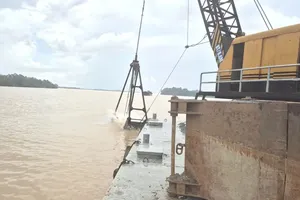
In Decision No.22/QD-TTg, released on January 8, 2024, the Prime Minister approved the comprehensive planning for the basin of Dong Nai River in the 2021-2030 period, with a vision to 2050.
The planned surface area consists of the Dong Nai River basin passing the administrative boundaries of HCMC and the provinces of Dong Nai, Binh Duong, Binh Phuoc, Tay Ninh, Ba Ria-Vung Tau, Dak Nong, Lam Dong (exclusive of the area in Long An Province in the comprehensive planning for Cuu Long River basin), and the area of Ninh Thuan Province, Binh Thuan Province that receive water transfer from the Dong Nai River basin.
This planning has six sections of upper Dong Nai River, lower Dong Nai River, Saigon River – upper Vam Co River, Be River, La Nga River, and coastal areas.
The aim of this planning is
- to ensure water security in both the river basin and the whole planned area;
- to store, regulate, and allocate water resource justly and reasonably;
- to exploit and use water economically for sustainable development;
- to answer the water needs of the community;
- to ensure socio-economic growth and national defense, security;
- to protect the environment and preserve the existing ecosystems as well as biodiversity.
)