The National Center for Hydro-Meteorological Forecasting reported at 3 a.m. on October 9 that the largest flood in years in Northern Vietnam had entered a transitional phase: water levels in upstream areas had begun to recede, but downstream rivers continued to rise, posing the most serious threat today.
Sunshine returns, but floodwaters keep rising
Despite two days of sunshine, floodwaters have continued to surge downstream. After sweeping through Thai Nguyen and Lang Son, the massive flood volume in the North has been shifting strongly toward the lower stretches of the Cau and Thuong rivers, inundating northern parts of Bac Ninh Province.

According to the Vietnam Meteorological and Hydrological Administration (under the Ministry of Agriculture and Environment), as of 11 p.m. on October 8, water levels in Thai Nguyen and Lang Son had started to recede. However, in the Bac Giang–Bac Ninh area (now merged into Bac Ninh Province), the floods continued to rise and were expected to peak this morning.

Of note, although the Northern region has seen no more rainfall, hydrological stations on the Cau and Trung rivers — at Dap Cau, Cau Son, and Phu Lang Thuong — still recorded water levels 1 to 2.4 meters above alarm level 3, surpassing even the historic flood record of 1986.


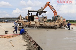
In northern Bac Ninh, from the afternoon to late night of October 8, several embankments in Yen Dung, Viet Yen, and Luc Nam had to be urgently reinforced overnight as water began overtopping them. In Tien Luc Commune and the Ha Chau–Dong Cao area (formerly Pho Yen), the Cau River swelled rapidly, forcing residents to pile sandbags and soil to block the flow. Many villages along the Cau and Thuong rivers were submerged, and several households had to evacuate in the middle of the night.
Hydrologists attributed the severe flooding mainly to the simultaneous release of water from upstream basins — including the Cau, Cong, and Trung rivers — which is moving slowly downstream.

Earlier, at Gia Bay Station in central Thai Nguyen, the flood peak on the Cau River had surpassed the 2024 historic flood level (caused by typhoon Yagi) by more than one meter. With steep terrain and narrow valleys, Thai Nguyen is prone to flash flooding as prolonged rainfall drives water from the forested headwaters in Dinh Hoa, Vo Nhai, and Phu Luong into the lowlands, while small, constricted rivers slow drainage.

However, experts noted that the deeper cause lies in deforestation and rapid urbanization, which have destroyed natural water-retention areas, making floods increasingly intense. In Huu Lung Ward (Lang Son Province), thousands of homes were inundated as floodwaters from the Trung River surged from the mountains and met rising water from the Thuong River downstream, creating a “reverse flood” phenomenon.
Overall, the current flooding has not spread across all of Northern Vietnam but has been concentrated in three main basins — the Cau, Thuong, and Trung rivers — affecting Thai Nguyen, Bac Ninh, and Lang Son provinces. The floodwaters are now gradually moving toward the lowlands, expected to flow into the Thai Binh River system and discharge into the Hai Phong area over the next few days. Other basins, such as the Red, Da, and Lo rivers, have seen no significant flooding in this weather event.
Over 200,000 homes submerged
According to Mr. Duong Xuan Huyen, Vice Chairman of the People’s Committee of Lang Son Province, about 5,083 households in the province have been affected by the flooding. Widespread inundation occurred in communes such as Yen Binh, Van Nham, Huu Lung, Tuan Son, Cai Kinh, That Khe, Trang Dinh, and Quoc Viet.

Ms. Nguyen Thi Loan, Vice Chairwoman of the People’s Committee of Lang Son Province, said flooding and landslides in the province had left four people dead, two missing, and two injured. Around 200,000 households have been inundated. Nearly 1,000 people have been mobilized to urgently reinforce a 500-meter section of the Cau River dyke with sandbags to prevent overflow.
The Department of Dike Management and Natural Disaster Prevention under the Ministry of Agriculture and Environment reported that as of the evening of October 8, heavy rains and floods following typhoon No.11 had left 13 people dead or missing and seven injured in Northern Vietnam.
Floodwaters cresting in Thai Nguyen, moving downstream toward Bac Ninh
As of the morning of October 9, the National Center for Hydro-Meteorological Forecasting reported that on the Cau River in Thai Nguyen, water levels at Gia Bay Station were falling but still above alarm level 3. In Lang Son, the Trung River at Huu Lung was also receding but remained about three meters above the danger threshold.

Conversely, in Bac Ninh, the Cau and Thuong rivers continued to rise. At Dap Cau Station, water levels were 1.1 meters above the alarm level 3, while at Phu Lang Thuong Station (formerly in Bac Giang), levels had exceeded the 1986 historic peak by 18 centimeters. At Cau Son Station (lower Trung River), water levels had reached their crest and were expected to remain high for several more hours.
Forecasters predicted that within the next 12 hours, water levels in these downstream areas would peak and then begin a slow decline. By tonight and early tomorrow, levels at Gia Bay (Thai Nguyen) are expected to drop to alarm level 2, while Dap Cau will remain about half a meter above alarm level 3, and Phu Lang Thuong and Cau Son will still be 0.7–1.2 meters higher.
Although the skies have cleared, experts warned that widespread flooding will likely persist for another two to three days in Thai Nguyen, Bac Ninh, and Lang Son, especially in low-lying riverbank areas.