The implementation of Geographic Information Systems (GIS) is increasingly prevalent across major global metropolises, serving as a critical tool for detailed urban data capture. This technological application is pivotal in the development of smart cities and the subsequent enhancement of the quality of life for urban residents. Nationally, the adoption of this technology has become widespread, with notable and extensive implementation in cities such as Ho Chi Minh City.
The government in China’s Shanghai has implemented GIS in the development of a comprehensive 3D geographic model for the entire city. The 3D GIS represents reality within a virtual environment using geographic coordinates, and it can even model indoor and underground spaces, aiding urban planning, cityscape management, and cultural heritage preservation.
Numerous countries have utilized GIS for supply chain management in the retail sector, enabling suppliers and retailers to track when produce leaves the fields, the transportation routes, as well as the quality and timing of deliveries. This technology also assists in identifying optimal locations for infrastructure development such as shopping centers, residential areas, schools, and hospitals. Furthermore, GIS technology aids health organizations in analyzing trends, identifying areas with disease occurrences, and assessing the risk of disease outbreaks.
In Vietnam, GIS has been adopted by various localities. The former Binh Duong Province previously launched the project "Establishing a Geographic Information System and Specialized Construction Software" at the portal http://gisxd.binhduong.gov.vn, which facilitates access to architectural and planning information, technical infrastructure, and urban development for residents, agencies, and businesses.
Meanwhile, Bac Ninh Province is focusing on developing a shared database and an integrated management information system based on GIS, applicable in various fields such as industry and trade, transportation, education and training, planning, and construction. Many systems have even been implemented quite early, such as the Dong Nai Technology and Environmental Status Information System (DONAGIS), the former Geographic Information System of Ben Tre Province (BETEGIS), and the previous system of Quang Nam Province (QANAGIS) aimed at supporting agricultural management.
In Ho Chi Minh City, GIS is widely utilized as a technological platform serving social life. The Geographic Information System Application Center (HCMGIS) under the Department of Science and Technology of Ho Chi Minh City has developed a digital transformation platform at the ward and commune level - a data management and operational system designed in WebGIS format that has the capability to connect, synchronize, and share web service data.
The system features a user-friendly interface, optimized for mobile devices and offering highly customizable reporting and statistical tools. It has already been piloted in several wards of Ho Chi Minh City. According to Deputy Director of HCMGIS Pham Duc Thinh, the database is designed to be stored and managed on the city’s shared server infrastructure. He added that the system is open, scalable, and upgradable; therefore making it easy to transfer and apply widely across localities in state management.
In addition, the city has launched a shared digital map service that provides a diverse collection of base maps, including administrative, transportation, topographic, satellite, and 3D building maps. Users can easily access information on addresses, transportation networks, education, healthcare, environment, and local administration throughout the city. Data is continuously updated from official sources, integrating contributions from municipal departments, agencies, and districts.
GIS is a specialized computer tool for collecting, managing, storing, and analyzing geospatial data, as well as visualizing it on maps. It supports decision-making and strategic planning across diverse fields such as urban planning, environmental management, and transportation. GIS enables environmental managers to visualize, analyze, and interpret data related to the Earth’s surface.
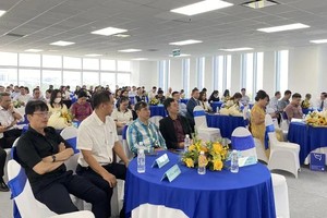
Most recently, HCMGIS applied GIS technology to land management and the oversight of facilities within the National Historical and Cultural Park in Ho Chi Minh City. This marks a significant step forward in using geographic information systems to manage cultural heritage, land resources, and infrastructure—addressing the city’s practical needs in modernizing urban governance. HCMGIS has successfully built a database of 20 information layers, covering elements ranging from buildings, transport, and green spaces to intangible cultural assets such as festivals and folk arts.
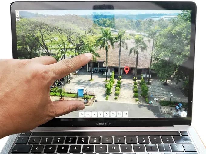
For the first time, the park’s extensive data has been fully digitized, integrated, and centrally managed. The GIS software system has been developed with 13 functional groups, with key strengths in land and facility management, tourism promotion through digital maps, and, notably, 3D/360-degree modeling to recreate landmark structures. This feature not only enhances data visualization but also unlocks significant potential for smart tourism development.
The system is also designed to integrate with Ho Chi Minh City’s shared GIS database, contributing to the city’s smart urban development goals while promoting Vietnam’s cultural heritage to the world.
Director Pham Quoc Phuong of HCMGIS stated that over many years, the Ho Chi Minh City Department of Science and Technology has developed the HCMGIS Portal. This portal provides an integrated platform for sharing geospatial data, documents, and maps within the HCMGIS ecosystem, and has already facilitated the creation of numerous applications serving public life. There is an expectation that GIS technology will see even greater application in the future, thereby contributing to the development of a smart city.


